This Tiny Austrian Village Hides a Geological Wonder You Won’t Believe
Nestled between towering alps and a mirror-like lake, Hallstatt cradles a landscape shaped by ancient forces. I never expected such raw beauty—limestone cliffs rising straight from the water, salt caves whispering centuries of history, and mountains that seem to fold time itself. This isn’t just postcard perfection; it’s geology in motion. What makes Hallstatt’s terrain so unique? Let’s dive into the earth’s story, where water, salt, and stone crafted one of Europe’s most mesmerizing alpine villages.
The First Glimpse: Arriving in Hallstatt
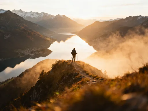
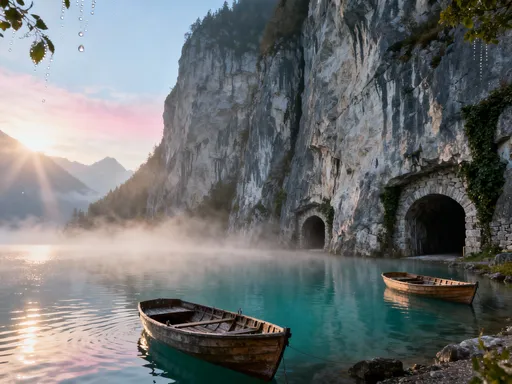
Reaching Hallstatt feels like stepping into a world suspended between sky and water. The village clings to a narrow strip of land between the steep rise of the Dachstein Mountains and the glassy surface of Hallstätter See, a deep alpine lake that mirrors the surrounding peaks with near-perfect clarity. Most visitors arrive by a small regional train that winds through mountain tunnels, then transfer to a quiet electric ferry for the final leg across the lake. There are no cars allowed in the main village—only footpaths, wooden boardwalks, and a single narrow road servicing emergency and service vehicles. This isolation, dictated entirely by geography, has preserved Hallstatt’s charm and contributed to its designation as a UNESCO World Heritage Site in 1997.
The immediate visual contrast is striking. On one side, the stillness of the lake offers a sense of peace, with gentle ripples breaking only when a bird dives or a boat glides by. On the other, the cliffs rise almost vertically, their gray and beige rock faces scarred by millennia of weathering. The buildings of Hallstatt—painted in soft pastels with flower boxes overflowing with geraniums—seem delicately placed, as if balanced on the edge of a natural stage. This dramatic juxtaposition is not accidental; it is the result of powerful geological processes that carved the valley and made this unique settlement possible.
Because flat land is so scarce, development has always been constrained. Houses are built upward rather than outward, often perched on stilts over the water or anchored into the mountainside with stone foundations. Even the cemetery, one of the most photographed in the world, is tucked into a small terraced plot behind the village, accessible only by foot. The limited access has helped control over-tourism, though the village still welcomes tens of thousands of visitors each year. To manage foot traffic, local authorities have implemented timed entry systems during peak months and restricted the number of daily ferry trips. These measures reflect a broader effort to balance preservation with accessibility, ensuring that Hallstatt remains not just a destination, but a living community shaped by its environment.
Where Mountains Meet Water: The Valley’s Unique Formation
The story of Hallstatt begins over 200 million years ago, when this region lay beneath a shallow tropical sea. Over time, layers of sediment accumulated, eventually forming the limestone and dolomite that now make up the Dachstein massif. But the valley as we see it today was shaped much more recently—geologically speaking—during the last Ice Age, which ended about 12,000 years ago. Massive glaciers advanced and retreated across the region, carving deep U-shaped valleys with their immense weight and slow, grinding movement. Hallstatt lies in one of these glacial troughs, a narrow corridor where ice once flowed like a slow-motion river of destruction and creation.
As the glaciers melted, they left behind a landscape transformed. The weight of the ice had depressed the Earth’s crust, and when it lifted, the land began to rebound—a process that continues subtly today. The resulting basin filled with meltwater, forming Hallstätter See. But the lake’s existence is not just a product of glacial action; it also sits atop a tectonic fault line, where the Earth’s crust has cracked and shifted over millions of years. This combination of glacial carving and tectonic activity created the deep, narrow lake we see now, with waters reaching depths of over 80 meters in some areas—remarkable for such a small body of water.
The surrounding peaks, including the towering Dachstein, rise over 2,000 meters above sea level, creating a dramatic backdrop that influences everything from weather patterns to tourism. The valley’s orientation—running roughly east-west—means it receives limited sunlight in winter, contributing to long, cold months when snow blankets the rooftops and ice forms along the lake’s edges. Yet this same topography creates microclimates that support diverse plant life, from alpine meadows to dense conifer forests. The interplay between ice, water, and rock continues to shape the valley, not just in appearance but in function, making Hallstatt a living example of how geological forces define both landscape and life.
Understanding this formation helps explain why the village developed where it did. The narrow strip of land between lake and cliff offered the only viable space for settlement, protected from avalanches by the surrounding ridges and close enough to the water for fishing and transportation. Even today, new construction is limited by these same natural boundaries, reinforcing the idea that in Hallstatt, humans do not dominate the landscape—they adapt to it.
The Salt Beneath Our Feet: Hallstatt’s Geological Heart
Beneath the picturesque facades and serene lake views lies the true foundation of Hallstatt—salt. The village’s name itself is derived from the German word for salt, and for good reason. The Hallstatt Salt Mine, known locally as the Salzwelten, has been in operation for over 7,000 years, making it one of the oldest continuously worked mines in the world. But the salt deposits are far older, originating in the Permian period around 250 million years ago, when an ancient inland sea evaporated under a hot, dry climate. Over time, the salt was buried under layers of sediment, compressed, and preserved deep within the Earth’s crust.
The discovery of these deposits transformed Hallstatt from a remote mountain settlement into a center of trade and wealth. Early miners used primitive tools to extract halite, the mineral form of rock salt, which was highly valued for food preservation and as a trade commodity. Archaeological evidence, including well-preserved wooden tools and even human remains, has been found in the mine, offering a rare glimpse into prehistoric life. These findings have helped scientists understand not only ancient mining techniques but also the environmental conditions of the time.
From a geological perspective, the mine is a treasure trove. As tunnels were dug deeper into the mountain, they exposed layers of rock that had been hidden for millions of years. Visitors on guided tours can see distinct strata of limestone, shale, and salt, each representing a different chapter in Earth’s history. The salt layers themselves are not pure white but streaked with gray and brown, evidence of trapped sediments and organic material. In some areas, the rock walls glisten with moisture, a reminder that water continues to move through the mountain, slowly dissolving and redepositing minerals.
Modern monitoring systems track subtle movements in the Earth’s crust around Hallstatt, as the region remains geologically active. Small earthquakes are occasionally recorded, and the land continues to rise slightly due to post-glacial rebound. While these changes are not dangerous, they underscore the dynamic nature of the landscape. The salt mine, once a source of economic survival, has become a window into deep time—a place where the past is not just remembered but physically present in the rock.
Cliffs That Tell Time: Reading the Rock Layers
The cliffs surrounding Hallstatt are more than just dramatic scenery—they are open books of Earth’s history. From a distance, the rock faces appear as simple bands of light and dark stone, but up close, they reveal intricate patterns of layering, folding, and faulting. Each stratum represents a different era, a snapshot of environmental conditions from hundreds of millions of years ago. The dominant rock types—limestone and dolomite—were formed in shallow marine environments, when the region was covered by a warm sea teeming with life. Over time, the skeletons and shells of marine organisms accumulated on the seafloor, compressing into the solid rock we see today.
One of the most compelling pieces of evidence for this ancient sea is the presence of fossils. Embedded in the rock are the remains of crinoids, corals, and ammonites, preserved in remarkable detail. These fossils are not just curiosities; they are crucial tools for geologists, helping to date the rock layers and reconstruct past climates. In some areas, entire slabs of cliff face appear to be made of fossilized coral reefs, a testament to the vibrant ecosystems that once thrived here. Erosion, caused by wind, rain, and freeze-thaw cycles, has gradually exposed these layers, making them visible to both scientists and visitors.
Guided geological walks along the mountainside allow visitors to observe these formations up close. Knowledgeable guides point out features such as cross-bedding, ripple marks, and even ancient mud cracks—subtle clues that reveal how the sediments were deposited. Some tours include visits to small outcrops where visitors can touch the rock and see fossils with their own eyes. These experiences transform the landscape from a passive backdrop into an active classroom, where the forces of time and nature are made tangible.
The clarity of these exposures is rare, even in alpine regions. Because Hallstatt lies in a relatively stable tectonic zone, the rock layers have not been overly distorted by folding or faulting, allowing for a more straightforward interpretation of geological history. This makes the area particularly valuable for educational purposes, attracting students and researchers from across Europe. The cliffs, therefore, serve a dual purpose: they are both a natural wonder and a scientific resource, reminding us that beauty and knowledge often go hand in hand.
Water’s Sculpting Power: From Lake to Cave Systems
While the mountains and salt define much of Hallstatt’s geology, it is water that continues to shape the landscape in subtle but powerful ways. Rain and snowmelt seep into the ground, where they encounter the soluble limestone that dominates the region. Over time, this water dissolves the rock, creating a network of underground channels, sinkholes, and caves—a phenomenon known as karst topography. These features are not always visible, but their presence is felt in the way water moves through the landscape.
One of the most common karst features in the area is the ponor, a natural opening where surface water disappears into the ground. During heavy rains or snowmelt, small streams may flow briefly across the surface before vanishing into these underground drains. This subsurface drainage system helps prevent widespread flooding but can also lead to sudden changes in water levels, particularly in the lake. In some years, rapid snowmelt has caused temporary rises in Hallstätter See, affecting boat access and shoreline paths.
Beneath the surface, the dissolved limestone has created small cave systems, some of which are accessible through guided tours. These caves are not large like those in other parts of the world, but they offer insight into the slow, persistent work of water. Stalactites and stalagmites form drip by drip, with some growing only a few millimeters per century. The air inside is cool and damp, and the silence is profound, broken only by the occasional drip of water echoing through the chamber.
Because the terrain is unstable in places, authorities strictly prohibit unauthorized cave exploration. Rockfalls and collapses are a real risk, especially after periods of heavy rain. Signs throughout the village warn visitors to stay on marked trails and avoid climbing on loose scree slopes. These precautions are not just about safety—they are also about preservation. Every rock and stream is part of a delicate balance that has taken millennia to form. By respecting these natural systems, visitors help ensure that Hallstatt’s geological wonders remain intact for future generations.
Living With the Landscape: How Geography Shapes Daily Life
In Hallstatt, geography is not just a backdrop—it is a daily reality. With less than 100 meters of flat land between the lake and the cliffs, every decision about building, transportation, and tourism is influenced by the terrain. Homes are built vertically, often with multiple levels connected by steep staircases. Some are even constructed on wooden pilings extending over the water, reminiscent of traditional stilt houses. New construction is tightly regulated, with strict height and design guidelines to maintain the village’s historic character and minimize environmental impact.
Landslide risk is a constant concern. The steep slopes above the village are prone to rockfalls, especially during periods of heavy rain or rapid snowmelt. To mitigate this, protective netting has been installed on several sections of the cliff face, and monitoring systems track ground movement in real time. In extreme cases, authorities may close certain trails or evacuate areas temporarily. These measures reflect a deep respect for the power of nature and a commitment to safety without compromising the village’s authenticity.
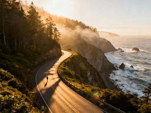
Seasonal changes bring their own challenges. Winters are long and snowy, with snowfall often cutting off overland access. During these months, the ferry service may be reduced or replaced with ice crossings when conditions allow. Spring brings the risk of flooding as snow melts, requiring careful management of drainage and water levels. Tourism, while vital to the local economy, must be carefully managed to avoid overcrowding. The village limits the number of cruise ships and day-trippers, and encourages overnight stays to spread out visitor impact.
Sustainability is a guiding principle. Electric boats replace diesel-powered vessels on the lake, reducing noise and pollution. Waste is carefully sorted and removed by barge, and single-use plastics are discouraged. Even the cemetery, with its centuries-old tradition of exhuming and painting skulls, has adapted to modern sensibilities—today, the practice is preserved as a cultural artifact but no longer actively practiced. These efforts show how a community can thrive in harmony with a challenging environment, balancing tradition, tourism, and environmental stewardship.
Why This Place Matters: Beyond Beauty, a Lesson in Earth’s Forces
Hallstatt is more than a beautiful village—it is a living testament to the power and patience of geological forces. Every rock, every ripple in the lake, every grain of salt tells a story that spans millions of years. It reminds us that landscapes are not static, but dynamic systems shaped by water, ice, pressure, and time. In an age of rapid change, Hallstatt offers a rare opportunity to witness the slow, steady work of the Earth, a counterpoint to the speed and noise of modern life.
Its preservation is not just about protecting a tourist destination; it is about safeguarding a natural and cultural record that has global significance. As climate change affects alpine environments—melting glaciers, shifting snow patterns, and increasing landslide risks—places like Hallstatt become even more important as indicators of environmental health. Scientists study the lake sediments, rock movements, and water quality to understand broader trends, using Hallstatt as a microcosm of larger planetary processes.
For visitors, the lesson is equally profound. It invites a shift in perspective—from seeing landscapes as mere backdrops for photographs to recognizing them as living, evolving entities. Mindful travel means taking the time to learn, to listen, and to respect the forces that shaped the places we visit. It means choosing experiences that honor local culture and ecology, rather than chasing fleeting moments for social media.
Hallstatt challenges us to look deeper. Beneath its postcard beauty lies a story of resilience, adaptation, and continuity. It teaches us that we are not separate from nature, but part of its ongoing narrative. By understanding the geology beneath our feet, we gain not only knowledge but a deeper connection to the world around us. So the next time you stand by a mountain lake or walk beneath a cliff face, remember: you are not just observing scenery. You are witnessing history—in the making.